This new version we spend on improving the usage of land surveying layers in Apglos Survey Wizard. Besides the land surveying layers we improved also other features in Apglos Survey Wizard. So check this out.
New in version 2.27 of Apglos Survey Wizard
And here is the list of all improvements in version 2.27 of Apglos Survey Wizard.
- Romanian languages added
- Exporting land surveying layers improved
- Saving TXT files improved
Romanian language added
Apglos Survey Wizard is a very easy to use land survey app. But of course it is even easier when you can use it in your own language. Even if you speak English or Spanish as your second language you can always understand things better, easier and faster in your native language.
And that is also how it goes with using a land survey app like Apglos Survey Wizard. That is why we added the Romanian language in version 2.27 of Apglos Survey Wizard. In this way our users in Romania can use this land survey app in their own native language.
That will help them to use this app even better. For example they can use it better by using land surveying layers.
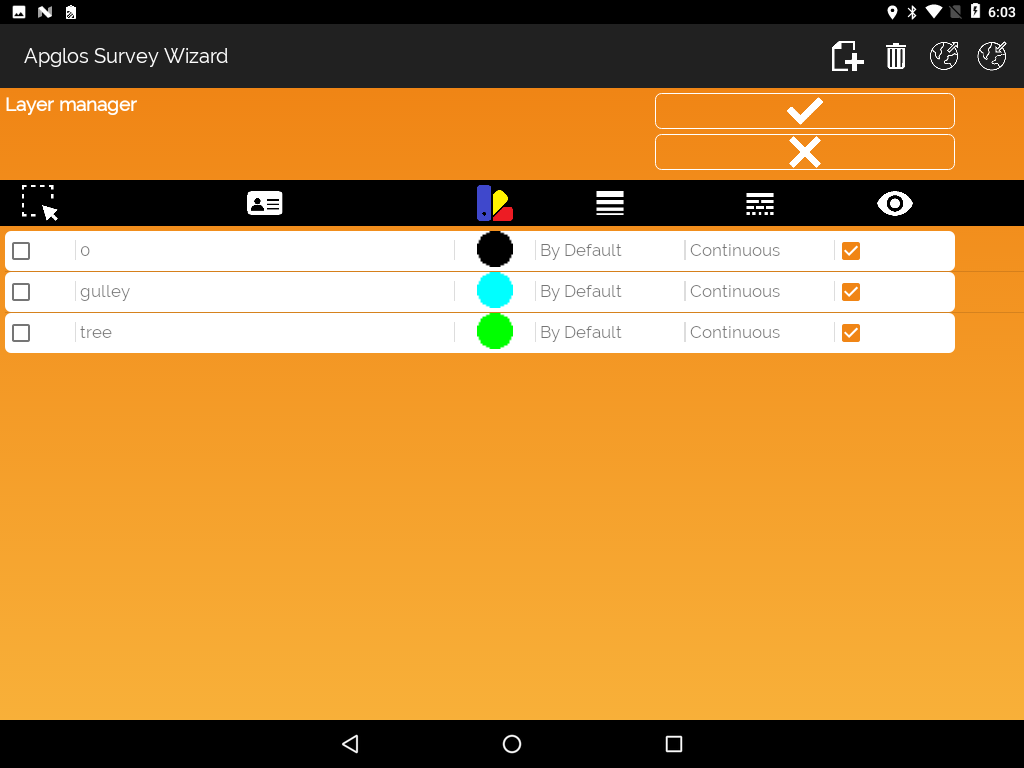
Improvement of exporting land surveying layers
And there is already the second great improvement in this version. We improved the exporting of land surveying layers in Apglos Survey Wizard.
You can use land surveying layers to name and describe the elements that you map. And in Apglos Survey Wizard that is very easy, because you just select the layer for your element and then you start mapping. In the layer manager of the app you can add layers manually.
But of course it is hard if for every project you need to add all the layers manually. That is why you can also import land surveying layers. To do so you already have to have them stored in a file.
And you can do that with Apglos Survey Wizard by exporting them. In version 2.27 we improved this function. You will be notified now if you didn’t select any layers to export. So then you will never be surprised anymore when you try to import layers and you don’t see anything happen.
Saving TXT files improved
And then there is the saving of TXT files. In a TXT file you can save all points that you map. In that file you can also have the land surveying layers saved. So then you know what the name and description is of the point you mapped.
By the improvement in the TXT files it is now easier to exchange data from Apglos Survey Wizard to any other type of software that uses TXT files for point information like Civil 3D of Autodesk.
And when you can exchange your data better between the software that you are using your work process will improve. You can work quicker with a better quality. And we all want that.
We keep on improving like with improving the usage of land surveying layers
So these three improvements are all great features in the land survey app Apglos Survey Wizard. We will keep on updating and improving Apglos Survey Wizard, like by this versions improvement of the usage of land surveying layers. If you gave any suggestions then you can even earn coins to use in Apglos Survey Wizard. If you want to know more about that then check this page. There is described how you can earn those coins with your suggestions.
And when you want to stay up-to-date on the new updates of Apglos Survey Wizard then follow us on Linkedin and Youtube to stay up-to-date. If you want to know more about Apglos Survey Wizard and all its general functions, than check this page. We explain you all the general functions of this simple land survey app Apglos Survey Wizard.