The coordinate reference system determines in which coordinates form the output of the land survey app Apglos Survey Wizard. So it is important to use the correct coordinate reference system. Here we will explain how you can change the system to the correct coordinates.
Coordinate reference system, the video
Besides the description on this page we also made a video on this topic. So if you prefer seeing a video and learn to change the coordinate system that way then we you can check this video.
It is a short video and it will explain you enough for changing the coordinate reference system.
Preparation
Of course you have to be logged in Apglos Survey Wizard to follow this complete tutorial. When you are logged in then you can start this tutorial from all main screens, like land survey, stake out, draw and calculate.
Changing the coordinate reference system
So first you have to go to the ‘settings‘ screen. To do so you first click on the icon of the file menu.
![]()
After that you will see a dropdown menu.
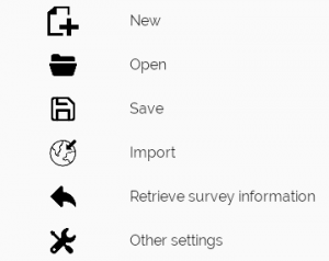
You see several options. But you have to click on ‘Other settings’. This will take you to the ‘settings’ screen.
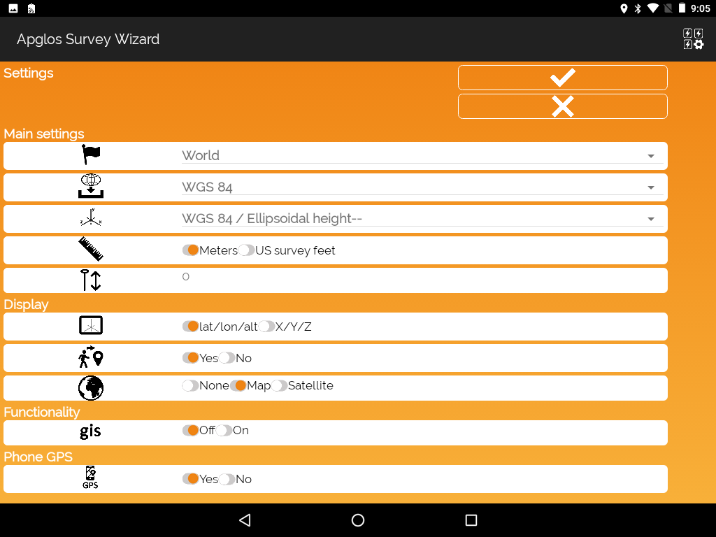
The coordinate reference system consists of three different parts. There is the country the incoming ellipsoid and then the coordinate system.
First we need to change the country to the country where you are in. This you do by clicking the country behind the icon with the flag.
![]()
When you click on the selected country you will see a long list of all countries that their coordinate systems are in Apglos Survey Wizard. You select the country you need.
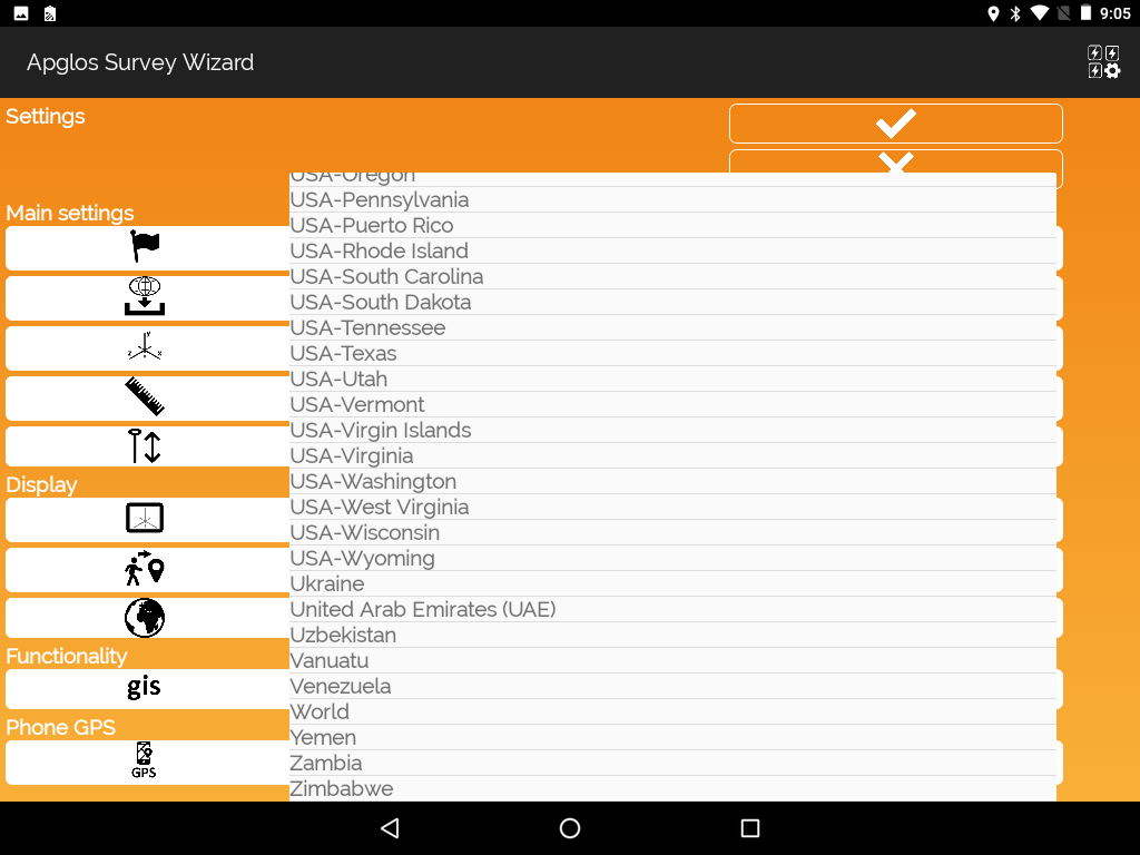
In our example we chose Netherlands. But you can change any other. After that you see that the selected items at the incoming ellipsoid and the coordinate system change.
The incoming ellipsoid has to be selected for the land survey app to determine how the latitude and longitude have to be transformed to the selected coordinate reference system. This depends a lot on the CORS network. So you better ask your CORS provider which ellipsoid they send out.
To change the ellipsoid you click on the selected ellipsoid behind the icon of incoming ellipsoid.
![]()
In our example there is only one ellipsoid for the Netherlands.

So in our example we select ETRS89. The final step is to select the coordiate reference system behind the icon of this system.
![]()
In our example for the Netherlands with the incoming ellipsoid ETRS89 there are two options.
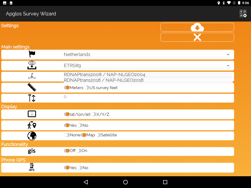
In our example we chose RDNAPTRANS2008 / NAP – NLGEO2004. This name of the coordinate reference system consists of three parts:
- Coordinate system
- Vertical datum
- Geoid used
Finalizing the coordinate reference system
To use the coordinate reference system Apglos Survey Wizard needs data, like the geoid and sometimes ntv2 files. These files Apglos Survey Wizard downloads automatically after clicking on the ‘download’ button.
![]()
So if you see this button then click on it. Apglos Survey Wizard downloads all necessary files.
After the download you will see the ‘OK’ button.
![]()
Click on this button and you will go back to the main screen. Apglos Survey Wizard might need some time to set up all concerning the coordinate system chosen. But after that you can work with your chosen system of coordinates.
No Apglos Survey Wizard yet?
If you want to know more about Apglos Survey Wizard then you can check more here.