What is the most accurate land survey app, is a question what you might be wondering if you start to land survey. And this is a normal question, because if you start land surveying then you want your surveys to be accurate. But technically the question is incorrect. And in this article I will explain you why it is incorrect.
What is the most accurate land survey app? All land survey apps use the position of the external GNSS receiver or phone. There is no land survey app that increases the accuracy of those devices. So all land survey apps have the same accuracy.
To explain you more about this topic I will answer you some more questions on this topic:
- How does a land survey app gets its position?
- How you can increase your accuracy of your land survey app?
- What are fixes in GPS surveying and what are their accuracies?
- Does Apglos Survey Wizard have any tricks for accuracy?
What is the most accurate land survey app? Quick solution
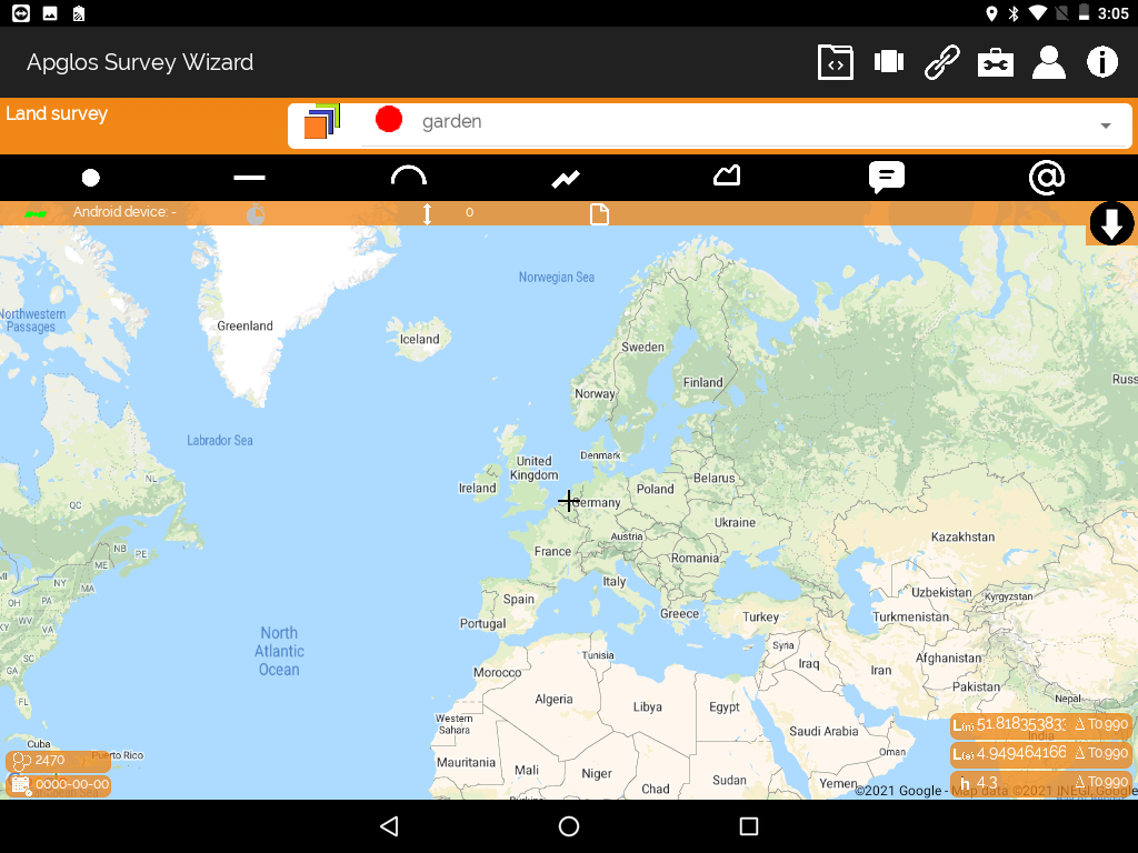
As I already mentioned a land survey app does not determine the accuracy of the position. A land survey app, like Apglos Survey Wizard, only makes sure you can work with the position it receives from the phone GPS or from the external GNSS receiver. If you want to try this land survey app then you can download Apglos Survey Wizard on the Play Store.
Apglos Survey Wizard is free to try. Because after registration you get 2500 coins for free that you can use in this land survey app. That is sufficient to try the complete GPS app.
But if you like Apglos Survey Wizard, and I think you will, then you can buy more coins or a time license in our webshop.
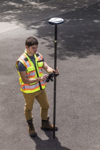
But if you want to have a high accuracy then you also need an external GNSS receiver. Because land surveying with only a phone GPS is not accurate enough. If you want to increase the accuracy for your land surveying then check out this page.
How does a land survey app gets its position?
There are many land survey apps. One of them is Apglos Survey Wizard. But all of the land survey apps have something in common. It is where they get their position from.
When you have installed a land survey app on a phone, then normally this land survey app will get the position from GPS of the phone. This is the same GPS that you are using when you use a navigation app on your phone.
Probably you have noticed, when you are using navigation with your phone GPS, that the accuracy is not that great. Your position might sometimes jump a bit around.
Of course that is not what you want when you land survey. That is why in case of land surveying a land survey app usually gets connected with an external GNSS receiver. When a land survey app is connected with an external GNSS receiver then the app uses the position that is determined by the external GNSS receiver.
In both methods the land survey app is only using the position of some device. Besides the position also the accuracy is determined by the device. No land survey app is improving the accuracy of the received position.
How you can increase your accuracy of your land survey app?
You can not increase the accuracy of your land survey app. But you can increase the accuracy of your complete GPS system that you are using to land survey.
To get the best accuracy for GPS surveying you do need an external GNSS receiver and not just a phone with a land survey app.
When you are checking for an external GNSS receiver then the most important thing is to see which satellite signals it receives. Of course you have the satellite constellations GPS, GLONASS, GALILEO and BEIDOU.
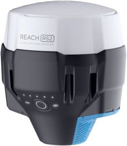
But those satellite constellations also have different types. For example GPS has L1, L2 and L5. The more of those satellite signals can be received the better the external GNSS receiver will work in rough conditions.
For an external GNSS receiver a rough condition is when satellite signals gets blocked, for example by trees or buildings.
But with only an external GNSS receiver you will not have the accuracy that you need for surveying land. The reason for this is that the atmosphere causes a deviation in the satellite signals. That is why the position of the external GNSS receiver needs to be corrected by another GNSS receiver that receives the same satellite signals.
This second GNSS receiver has to be on a steady place. There are two possibilities to connect your external GNSS receiver with a second GNSS receiver. First there is the radio method, which is used when you have two external GNSS receivers. One is then the rover and the other one is the base.
The other option is to connect your external GNSS rover through internet with a CORS network.
With both options you will be able to get a position with high accuracy.
What are fixes in GPS surveying and what are their accuracies?
Maybe you think that accuracy is just a description of how far in distance the measured point is away from the real position of an object. And then you are right.
In GPS surveying this accuracy is also mentioned in fix types or fixes. There are different fixes. You have SPS, DGPS, Float RTK and RTK.
| Fix | Accuracy |
|---|---|
| SPS | > 10 m |
| DGPS | 1-5 m |
| Float RTK | 10-20 cm |
| RTK | 1-2 cm |
As you can see in the table above there are different accuracies for the different fixes. When you want to do a real accurate land survey then you only want to do land survey with an RTK fix. All other fixes are not optimal for land surveying, because their accuracy is not high enough.
Does Apglos Survey Wizard have any tricks for accuracy?
That is why land survey app Apglos Survey Wizard does have some tricks. The first trick is that you can connect Apglos Survey Wizard with an external GNSS receiver. And you can fill in and connect this land survey app with a CORS network so you can get an RTK fix.
Another trick is the accuracy security. Standard settings of Apglos Survey Wizard are that you can not map any object without an RTK fix when you are connected with an external GNSS receiver. There is the possibility to change this accuracy security to Float RTK, DGPS or SPS.
Also you can change it to an accuracy distance.
But of course you only should change the accuracy security of Apglos Survey Wizard when it is good for the purpose that you want to use this land survey app for.
At last Apglos Survey Wizard has an option to map accurate. When you use this option the app takes the average of all positions that are done in a certain period of time. That will increase accuracy.
Conclusion of “What is the most accurate land survey app?”
As you probably understand by reading this article a land survey app does not have any influence on the accuracy of a land survey.
But Apglos Survey Wizard has some tricks that can help you to only map objects with a high accuracy. So if you are looking for the most accurate land survey app then for sure it is worth to try Apglos Survey Wizard. You can download it in the Google Play Store. It is free to try. Of course if you want to use Apglos Survey Wizard more then you can always buy more coins or a time license in our webshop.
And if you want to land survey with high accuracy then you also need an external GNSS receiver. You can find more about external GNSS receivers here.